Kenya Expands Soil Mapping to Help Farmers Make Better Decisions
Provpnmatrix.com – Farmers in Kenya are gaining access to more detailed information about the land they cultivate through a national soil-mapping effort intended to strengthen food production as climate pressures become more severe. The initiative focuses on a basic but often overlooked starting point for agriculture: understanding the condition, nutrients and limitations of the soil before deciding what to grow or which inputs to apply.
Known as Soil Mapping for Resilient Agrifood Systems, or SoilFER, the programme is helping generate dependable soil data that farmers can use in day-to-day management decisions. The information is designed to guide choices on fertilizer type and quantity, while also helping producers recognize signs of declining soil health.
More than 3,600 samples have already been collected and mapped in 45 Kenyan counties. These results are contributing to a digital soil map that can provide location-specific details, recognizing that conditions can differ greatly from one farm to another and even across nearby areas.
Testing Before Planting
Soil testing can give farmers a clearer view of pH, fertility and nutrient needs. That knowledge matters when producers are considering fertilizer use, since applying more product does not necessarily mean higher harvests. Fertilizer that does not match the needs of a field can add costs without addressing the soil conditions affecting crop growth.
Kenya’s Cabinet Secretary for Agriculture, Mutahi Kagwe, encouraged farmers to place soil assessment at the centre of their planning.
“I want to urge Kenyans that before thinking about what to plant or the fertilizer to use, think about soil testing,” he said.
The SoilFER programme was launched in Kabete through a partnership involving the Food and Agriculture Organization of the United Nations and the Kenya Agricultural and Livestock Research Organization, known as KALRO. Financial backing has come from the United States Department of State and Japan.
As part of the work, three KALRO laboratories have been renovated and fitted with advanced equipment for analysing samples gathered around the country. Each sample is georeferenced, linking the findings to a specific place. Results can then be sent directly to farmers through their mobile phones, bringing technical information closer to the people who need to act on it.
Building a Network of “Soil Doctors”
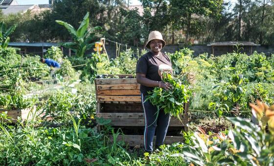
The programme also trains selected farmers to identify and respond to soil degradation. These trained participants are referred to as soil doctors, and their role extends beyond their own plots: they share what they learn with fellow farmers in their communities.
For Agness Munialo, a farmer from Kakamega county in western Kenya, the training has changed the way she views agricultural inputs and soil management. She said farmers had sometimes turned to increasingly heavy use of chemicals and fertilizer in the hope of increasing production.
“Farmers would use excessive chemicals, sometimes even more fertilizers in an attempt to get more yields. Now we know better,” she said.
Munialo, who took part in SoilFER training as a soil doctor, said the programme has helped farmers, especially those in rural communities, understand soil composition, fertility and pH levels. This kind of practical knowledge can make farm decisions more deliberate, from identifying potential nutrient gaps to recognizing when land may need different management practices.
The peer-learning model is particularly important because farmers often rely on local experience and trusted networks when changing their methods. Soil doctors can translate technical testing results into discussions rooted in the realities of nearby farms, helping make the broader mapping effort useful beyond laboratories and digital databases.
Information as Part of Climate Resilience
Climate shocks are increasing the need for agriculture that can adapt to changing conditions. Better soil information does not remove those risks, but it can give farmers a stronger basis for managing land sustainably and planning the use of limited resources.
Barrack Okoba, the national coordinator of the programme for FAO in Kenya, said accessible information is a key element of agricultural resilience.
“Part of resilience is to make sure that our information system is available and supporting farmers to build sustainable farm management,” he said.
The initiative is also drawing the attention of young people considering agriculture as a future opportunity. Jackline Kioko, a KALRO intern who attended the launch, said the material presented gave her a new perspective on decisions affecting her family’s farm.
“I’d love to do farming more, now that I have the information that you can actually test your soils to know what nutrients it requires,” she said.
Her experience reflects a wider value of accessible agricultural information: it can make farming appear more knowledge-driven and help younger people see how research, technology and practical fieldwork connect.
New Partnerships for Soil Health
The launch also introduced the Kenya Soil Partnership, the Kenya Soil Laboratory Network and the nationwide rollout of the Global Soil Doctors Programme. Kagwe called for closer cooperation among agricultural institutions so that decisions are coordinated, information can be shared more effectively and soil health becomes part of the work of all relevant bodies.
By combining sample collection, laboratory analysis, digital mapping, mobile communication and farmer-to-farmer training, SoilFER is building a system meant to make soil knowledge easier to use. The approach treats soil as more than the ground beneath a crop; it is a resource whose condition can shape fertilizer decisions, production prospects and longer-term farm sustainability.
Kenya is not alone in implementing the programme. SoilFER is also under way in Ghana, Guatemala, Honduras, Mozambique, Tunisia and Zambia. The work across these countries reflects a shared effort to place reliable soil information at the heart of resilient agrifood systems.
Related Reading
Frequently Asked Questions
What is Soil mapping aims to boost agricultural?
Soil mapping aims to boost agricultural is the main topic of this guide. The article explains the context, practical details, and next steps readers should understand.
Why does Soil mapping aims to boost agricultural matter?
Soil mapping aims to boost agricultural matters because readers are looking for a useful answer, not just a short summary. Good content should match search intent and help them decide what to do next.